re: surf spot above from JB ^^
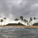
i was looking at this the other day because of a maintenance issue at another site, and i was actually quite surprised to see that the aerial shots from previous years actually show about the same amount of sand there annually going back the last few years. bearing in mind that the timing of the photo doesn't allow for what the tide was, but it is pretty apparent. FYI - i have surfed around that area since i was a grom, (mid90s), so it is funny what your memory tells you it "has always been like", and i have surfed it both as rocky as in the 2nd photo, but also with some sweet wedges bouncing off the front of the wall.
when it comes to "where does the build up come from and where is it going" questions, there is a fair bit of work on sediment cells for WA already published - can't remember if i linked this before, but here it is again
www.transport.wa.gov.au/imarine/coastal-erosion-and-stability.aspsediment cells for your area:
www.transport.wa.gov.au/mediaFiles/marine/MAC_R_CoastalSedimentCellsReport.pdfyours is G 29 (a and b most relevant) if you want to quickly find it.
basically you have to get a bit lucky with where these structures have been put - if it is a "node" , where sand kind of wants to be stored or heads on or offshore due to reef structures etc, then usually you don't get the build up permanently (and erosion downstream), and you see like what happens at your spot where the sand builds gradually over summer in prevailing southerlies, and then a couple of really brutal NW fronts rip it a) offshore, and b) send it back to the south, before it all goes starts over again with a slow push onto shore and a roll along the shoreline in the prevailing southerlies again. kind of like the usual bank formation but on a bigger scale
contrast this with say tweed heads, where if there wasn't pumping of sand annually from south to north, the beach on the other side of the channel would be 1km wide after 10 years and the erosion around snapper/kirra and further north would be even more insane. they got relatively lucky with hillaries, and pinnaroo point just downstream, as well - although some will say that hillaries has totally stuffed trigg/scabs. personally i think freo port over a much longer time scale, plus beach stabilising and grooming, has done that.
here are the photos that surprised me as well, in order we have 2010,2011,2013,2014,2015 - all in March to try to keep it relevant. i think there was less sand last year than this year, but wasn't far off this year back in 2011.


Thread hijack complete! cheers