Select to expand quote
myusernam said..
I recently had the displeasure of dealing with a 000 operator. The retard simply would not listen to me (she thought i waa hysterical ) ooh i must follow my training. There were no road names or street names where we were, and she kept trying to substitue where i said i was by using google. She was actively changing and suggesting place names. It was xxxx beach so she was googling and coming up with nearby places that had road names associated with them because her tiny brain couldn't grasp what i was saying. I threatened to hang up and dial the local police. I ended up calling them on another phone as she simply would not accept the widely known and published location name because thete was no street name to get there and her bing search didnt work in 4wd only remote area. Sounds like a good idea but heaven help you if you get the fxckwit i did
So there were no proper roads where you were and she was trying to find a landmark on Google to reference so she could get emergency service to you, as quickly as possibly and to the correct location the first time? and you call her the fxckwit? Sounds like she was doing her best help you!
Calling the local Police is only a short term solution, sure they might know where 'lefties' is but who said it's the local police that are going to turn up? You could ring the local police in Lancelin but if they're not available I've seen them drive from Gingin, Moora and Joondalup. And no point calling the police if you need am ambulance. If the local vollies are tied up already (highly likely on a weekend) then they will send a volunteer crew from Woodridge, Ocean Farms, Moora, Jurien Bay or a career van from Merriwa.
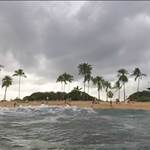
It's the local lingo for place names that cause the delays (along with people not actually knowing where they are). If I asked ten people that did the downwinder from Lancelin to Wedge to adequately describe a beach location halfway along I'd get ten different answers. Some would insist it's just up the beach from Lancelin, some would say Lefties, others Onions, bombing range (the break), others the actual bombing range, its near south rocks, its just south of Wedge, it's just south of Wedge Island, it's just near the big coke can on the bombing range. Most wouldn't know the locality/suburb between Lano and Wedge. At least one would try and describe where they are without using the name they know it as, as they don't want to give away their favourite secret break or fishing hole location.
I think these BEN signs are a knee-jerk reaction, they have been done by one local government to address one incident in their area and one-up the other coastal local governments. They should have taken it to the all the other local government first and got a consensus on making sure the signs are all consistent. And keep the information on them simple. Probably the most important being the GPS location. It never changes like formal and informal places names do over time. Every emergency call-taker can work with a GPS location, if they have to open google earth, they can then they find landmarks or references they need to work their own CAD system to despatch the job.
They did a very similar thing on the highway between Perth and Bunbury maybe 15 or 20 years ago, they had small signs every 2km or so so people could reference their location for serious crashes. It was a good idea but if they're even still there most wouldn't know to look for them or what they mean.
Alternately they need legislation and software in place so that if you call 000 on a smart phone the software automatically pings your phone and interrogates it's GPS for it's exact location but that probably won't happen because the civil liberty nuts would have a fit.
 Stuthepirate
> 9 months ago, 27 Jul 2016
Stuthepirate
> 9 months ago, 27 Jul 2016