I'm planning on doing a bit of cruising down the coast soon and was wondering what most people use to track and monitor weather and waves. I haven't done much boating out of sheltered waters and I'm a bit paranoid about being caught out in bad weather. I'm looking for some kind of map view showing pressure zones and wind and wave info etc...
Can anyone recommend something for that?
Select to expand quoteDale Christopher said..
I'm planning on doing a bit of cruising down the coast soon and was wondering what most people use to track and monitor weather and waves. I haven't done much boating out of sheltered waters and I'm a bit paranoid about being caught out in bad weather. I'm looking for some kind of map view showing pressure zones and wind and wave info etc...
Can anyone recommend something for that?
Have a look at windy.com
Select to expand quoteDale Christopher said..
I'm planning on doing a bit of cruising down the coast soon and was wondering what most people use to track and monitor weather and waves. I haven't done much boating out of sheltered waters and I'm a bit paranoid about being caught out in bad weather. I'm looking for some kind of map view showing pressure zones and wind and wave info etc...
Can anyone recommend something for that?
I would suggest keeping it simple and just use the marine forecasts for the area. I use Bom first followed by Seabreeze then if I was venturing further offshore the free version of this.
www.buoyweather.com/wxnav6.jsp?region=AS&program=nww3BW1&grb=nww3&latitude=-36.0&longitude=151.25&zone=10&units=e
BOM and Buoyweather are the most accurate but the Seabreeze timing is best.
Select to expand quoteDale Christopher said..
I'm planning on doing a bit of cruising down the coast soon and was wondering what most people use to track and monitor weather and waves. I haven't done much boating out of sheltered waters and I'm a bit paranoid about being caught out in bad weather. I'm looking for some kind of map view showing pressure zones and wind and wave info etc...
Can anyone recommend something for that?
a combo of windy.com and bom
You could try PredictWind. The free sections are quite good. It was my main weather source when sail up the east coast and beyond. Just download the App.
www.predictwind.com/
Predict wind and Willy weather ........ but as they say winds could be up to 40% higher as also the swell , gotta love the BOM cya
Select to expand quoteDale Christopher said..
I'm planning on doing a bit of cruising down the coast soon and was wondering what most people use to track and monitor weather and waves. I haven't done much boating out of sheltered waters and I'm a bit paranoid about being caught out in bad weather. I'm looking for some kind of map view showing pressure zones and wind and wave info etc...
Can anyone recommend something for that?
Meteye which is run by thr Bureau of Meteorology I find is the best source for coastal cruising.
www.bom.gov.au/australia/meteye/?loc=WA_FA001
Ilenart
Select to expand quoteIlenart said..Dale Christopher said..
I'm planning on doing a bit of cruising down the coast soon and was wondering what most people use to track and monitor weather and waves. I haven't done much boating out of sheltered waters and I'm a bit paranoid about being caught out in bad weather. I'm looking for some kind of map view showing pressure zones and wind and wave info etc...
Can anyone recommend something for that?
Meteye which is run by thr Bureau of Meteorology I find is the best source for coastal cruising.
www.bom.gov.au/australia/meteye/?loc=WA_FA001
Ilenart
Yep, mainly MetEye for me but I'll also check WIlly for very local stuff & sometimes Windy - the more opinions the better. :)
Thanks heaps for all the suggestions! I've been using WillyWeather, BOM forecasts and the Windy App so far but will check out the others mentioned before my next trip out!
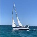
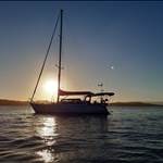
65nm and three bar crossings under my belt now! I'll have to start calling myself Captain Dale ;)